GPS jamming: The invisible battle in the Middle East
Key Takeaways
- GPS interference made hundreds of ships' broadcast positions appear clustered off Iran, UAE and Qatar
- Windward analyst Michelle Wiese Bockmann observed 35 distinct vessel clusters on live position maps
- Commercial vessels' AIS data showed large location anomalies in Strait-area waters
Maritime navigation disruptions
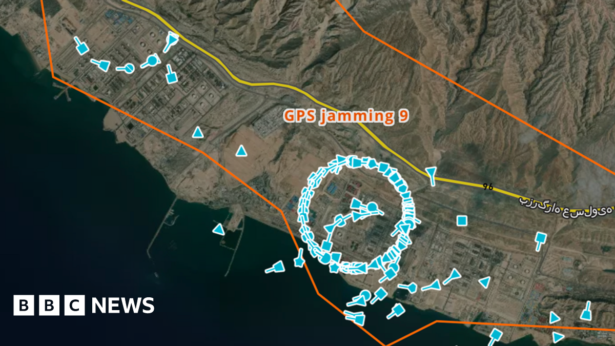
Michelle Wiese Bockmann, senior maritime intelligence analyst at Windward, describes seeing "35 different clusters" of ship positions on live maps off Iran, the United Arab Emirates and Qatar, with vessel icons bunched into tight, unnatural circles and even hovering over land.
“- Published Hundreds and hundreds of ships”
The BBC reports that those clusters reflect disrupted GPS coordinates and Automatic Identification Systems (AIS), creating a serious navigation hazard.
Large tankers take many kilometres to change course or stop, and if vessels cannot reliably know where nearby ships are, the risk of collision rises, especially at night or in poor visibility.
The article notes GPS jamming has affected aircraft in Europe, including a plane used by the President of the European Commission, is a daily feature of the war in Ukraine, and has now "spilled over yet more territory" into the Middle East.
Bockmann warns, "We can't over-estimate the huge danger this places to maritime navigation and safety."
More on Iran
Trump Says U.S. Bombed Military Sites on Kharg Island, Iran's Oil Hub
14 sources compared
FBI Warns of Iranian Drone Plot Based on Unverified Tip; California Says No Credible Threat
10 sources compared

White House Demands ABC Retract Report Claiming Iran Sought To Launch Drone Attacks On California
11 sources compared

Iranian Proxy Claims It Shot Down US Refueling Plane in Iraq; US Military Says Otherwise
17 sources compared