Technology and Science27 December, 20253 min read
Bomb Cyclone Threatens Upper Midwest and Great Lakes, Will Bring Blizzard Conditions and Power Outages to Northeast
This article is an automated aggregation of coverage from news outlets. Our editorials offer in-depth analysis curated by the NewsCord team.
Storm will rapidly intensify over Upper Midwest and Great Lakes, producing blizzard conditions New York City saw its heaviest snow in nearly four years; over 1,500 flights canceled

13 outlets told this the same way.
Incoming bomb cyclone threat
A rapidly strengthening winter system described as a possible "bomb cyclone" by some forecasters is expected to intensify over roughly 48 hours. The system will bring heavy snow, blizzard conditions and plunging Arctic air into the Plains, Upper Midwest and Great Lakes before moving toward the Northeast early next week. Straight Arrow News notes the rapid pressure drop definition of a bomb cyclone and warns of heavy snow, blizzard conditions, strong winds and plunging temperatures.
“A rapidly strengthening winter storm — dubbed ‘Winter Storm Ezra’ — is expected to bring heavy snow, blizzard conditions, strong winds and plunging temperatures across the Plains, Upper Midwest, Great Lakes and into the Northeast this weekend into early next week.”
The Associated Press says a powerful winter cyclone is intensifying as frigid Canadian air collides with unusually warm southern air. India Today and WebWire highlight multi-day hazardous conditions and statewide emergency preparations in New York as the system moves east.

Great Lakes winter storm
The Upper Midwest and Great Lakes are forecast to bear the brunt of the cold-air collision, with heavy, possibly blinding snow, whiteout and blizzard conditions in places and locally very high lake waves. Both Straight Arrow News and the Associated Press warn of totals over a foot in parts of the Upper Midwest and up to roughly 2 feet along Lake Superior's south shore; AP also forecasts lake waves topping 25 feet and dangerous wind chills down toward -30°F in parts of North Dakota and Minnesota. Local forecasts described scattered areas of 3-12 inches across the Upper Midwest (Twin Cities, Duluth, Green Bay), while officials warned of hazardous travel and power impacts for millions under winter storm warnings.
Northeast Winter Storm Impact
The Northeast, especially New York, Long Island, southern New England and the Mid-Atlantic, experienced a mix of freezing rain, sleet and snow.
“Central Park recording 4.3 in (11 cm) — the largest total since January 2022.”
In many places precipitation began as ice or mixed forms before warmer air changed some to rain.
New York City recorded its heaviest snowfall in nearly four years, with Central Park measuring 4.3 inches.
Other parts of the region reported 6 to 10 inches.
ABC News and airport reports noted more than 1,500 flight cancellations on Friday and widespread disruptions at New York City and Philadelphia airports.
State and city agencies moved to emergency footing.
Gov. Hochul declared a State of Emergency, transit agencies delayed planned work and readied crews, and officials urged people to avoid nonessential travel.
News outlets, including WebWire, documented the emergency declaration and the agencies' responses.
Northeast storm impacts and response
Travel and utility impacts were emphasized across sources. The AP and ABC reported thousands of flight delays and cancellations in the Northeast and Great Lakes.
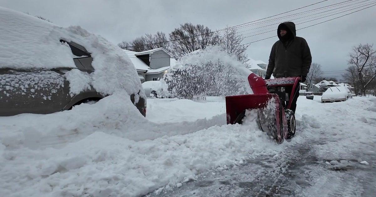
Straight Arrow News and WebWire warned of scattered power outages, ice storm warnings in parts of Pennsylvania and Massachusetts, and the likelihood of downed trees from heavy, wet snow. WebWire also lists operational responses - DOT and Thruway operators, utility crews on standby, and transit measures like rear-wheel chains on thousands of buses - that reflect preparations to limit outages and service interruptions.
Storm coverage differences
Coverage differs in emphasis and timing, with some outlets reporting the storm winding down locally and travel improving in spots. Other outlets continue to stress intensification, a broad blizzard risk, and the potential for severe secondary hazards. Forecasts and revised totals also vary by location, so readers should note these differences.
“The National Weather Service said the storm was winding down, with only light flurries remaining in parts of the region. New York City received about four inches of snow overnight into Saturday...”
Straight Arrow and AP portray a major cyclonic intensification described as a rapid 48-hour bomb cyclone. India Today and WebWire emphasize ongoing hazards and official advisories through Tuesday.
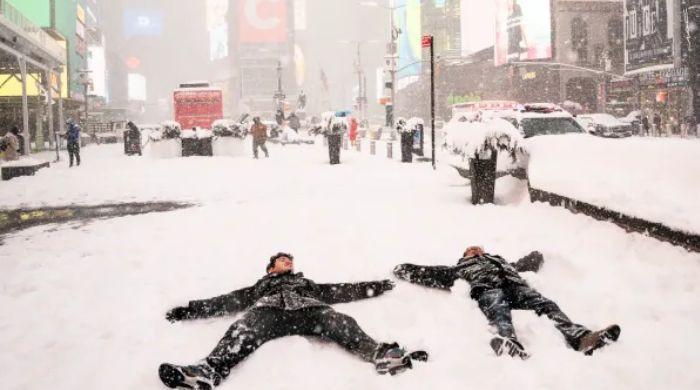
DNA India and News18 report localized improvement in New York City with about four inches of snow. Despite these differences, officials consistently advise avoiding nonessential travel, preparing for power outages, and following National Weather Service updates.