
China Maps Ocean Floor to Prepare for Submarine Warfare Against the United States.
Key Takeaways
- China runs an extensive ocean-mapping campaign with dozens of vessels across Pacific, Indian, Arctic.
- Data includes seabed terrain and water conditions to aid potential submarine warfare against the U.S.
- Civil-military fusion enables defense planning using mapped ocean data.
Mapping Program Scale
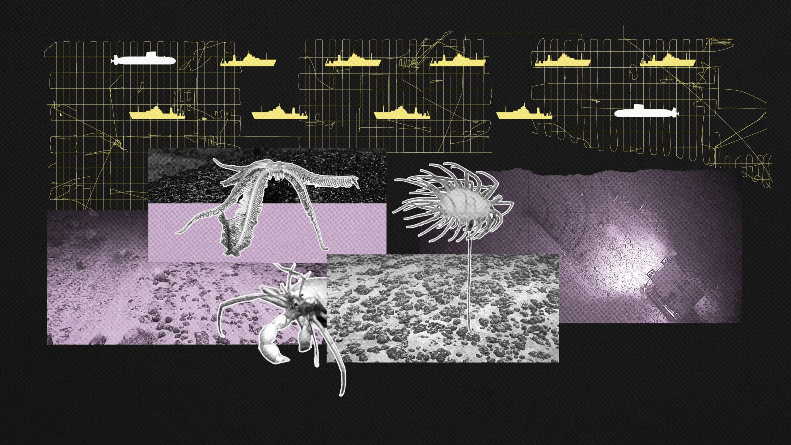
China has launched an extensive ocean floor mapping program spanning the Pacific, Indian, and Arctic Oceans, according to multiple sources tracking the initiative.
“2) was spotted about 19 nautical miles off the coast of the Philippines’ northern Cagayan province, with the Philippine Coast Guard dispatching an aircraft to challenge its presence after it said the vessel failed to confirm whether it was conducting marine research without Manila's consent”
The effort represents a significant strategic undertaking with military implications for submarine warfare against the United States and its allies.

One prominent vessel, the Dong Fang Hong 3 operated by Ocean University of China, has conducted repeated missions near Taiwan, Guam, and key areas of the Indian Ocean between 2024 and 2025.
Tracking data reveals that at least eight Chinese vessels are directly involved in seabed mapping, while approximately ten others transport specialized equipment.
This creates a comprehensive undersea intelligence network across strategically vital waters.
Strategic Target Areas
The mapping activities have focused on strategically significant areas surrounding U.S. military infrastructure and key maritime chokepoints.
Chinese vessels have repeatedly surveyed waters east of the Philippines along the First Island Chain—a strategic barrier formed by U.S. allies—and surrounding Guam, Hawaii, and Papua New Guinea.

Other critical areas include approaches to the strategically important Malacca Strait and waters near Japan where underwater sensors were tested.
The pattern of vessel movements shows repeated surveys of the same routes, a typical sign of detailed seabed mapping.
Vessels also operate in the Northern Mariana Islands, Guam, and Micronesia—areas that serve as vital U.S. military hubs and components of American Indo-Pacific strategy.
Civil-Military Fusion
Experts emphasize that China's oceanographic research serves a dual purpose, combining civilian scientific work with military objectives—a hallmark of Beijing's 'civil-military fusion' strategy under President Xi Jinping.
“Research missions are quietly tracing the ocean floor across strategic waters”
While officially described as scientific research studying climate or seabed soil composition, the collected data has significant military value for submarine operations.
The Ocean University's 'Transparent Ocean' initiative, launched in the South China Sea and expanded across multiple oceans, provides China with a growing undersea intelligence network.
This program, initially funded with $85 million from Shandong provincial authorities, collects detailed data on temperature, salinity, currents, and subsea activity.
The data can be converted into combat advantages through technological and research advances.
Strategic Military Value
Naval warfare specialists warn that the oceanographic data is strategically invaluable for submarine operations, enabling enhanced navigation, concealment, and positioning of seabed sensors or weapons.
The detailed mapping of seabed topography, underwater currents, and water characteristics allows submarines to avoid obstacles and remain undetected, while also improving the ability to detect enemy submarines.

Sound waves used by sonar behave differently depending on the seabed's topography and water conditions, making precise environmental data critical for modern naval warfare.
Analysts note that this comprehensive mapping could erode the long-standing advantage held by the U.S. Navy in understanding the undersea battlespace.
This represents a serious strategic concern for American military planners.
Environmental and Legal Concerns
The environmental and legal dimensions of China's deep-sea activities raise additional concerns.
While China's Ministry of Foreign Affairs states that its oceanographic activities 'highly value deep-sea environmental protection' and are conducted 'in accordance with the provisions of the United Nations Convention on the Law of the Sea,' experts note potential violations of international exploration zones.
Chinese vessels have been detected operating within other nations' contracted exploration areas in the Indian Ocean, including those of India, Germany, South Korea, Poland, France, and Russia.
This pattern of activity could reflect a broader strategy to lead in deep-sea mining once commercial extraction begins.
Analysts suggest China is 'playing, as it does in many cases, with international law' to establish dominance in emerging undersea resource domains.
More on China

US Demands Mexico End Cuban Medical Missions
14 sources compared

U.S. and Israel strike Iran, triggering West Asia crisis, Strait of Hormuz closure, energy shocks
52 sources compared

China Offers Taiwan Energy Lifeline If It Accepts Reunification; Taiwan Rejects Proposal
10 sources compared
China Resumes Large Scale Military Flights Around Taiwan, Taiwan Reports 26 Aircraft in 24 Hours
14 sources compared