
National Weather Service Confirms Large Tornado Near Streator, Illinois; Tornado Watch Until 9 P.M.
Key Takeaways
- A large tornado touched down near Streator, Illinois.
- Tornado warnings were issued for Grundy, Kankakee, and Livingston counties.
- Power outages and downed trees disrupted the Chicago area.
Tornado near Streator
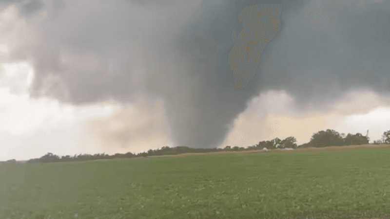
The National Weather Service confirmed a large tornado touched down near Streator, Illinois on Thursday, with the tornado impacting southern and southeastern portions of Streator as of 5:52 p.m.
“Over 600 flight cancellations at Chicago airports, events delayed across city CHICAGO (WLS) -- After strong thunderstorms moved through the Chicago area Wednesday, toppling trees and causing power outages, another round of storms is forecast for Thursday”
NBC 5 Chicago said debris signatures were observed on Doppler radar as the storm moved through the Streator area, and it reported structures damaged on the south side of Streator with Illinois State Police confirming damage to NWS.

NBC 5 Chicago also reported tornado warnings were still ongoing in Livingston and LaSalle counties as the storms moved to the east-northeast.
In a separate local forecast, WEEK said a Tornado Watch was issued for all of Central Illinois until 9 p.m., with concerns including strong wind gusts upward of 75-80 mph and large hail upward of at least 1.5″ in diameter.
Watches, warnings, and outages
As the Chicago area braced for additional severe weather, WGN-TV reported a Tornado Watch until 9 p.m. for the Chicago area and said the entire metro area was at a heightened (level 4 of 5 Moderate Risk) for severe thunderstorms on Thursday.
WGN-TV said the second round of storms was expected between 4 p.m. and 9 p.m., when destructive wind gusts between 70 and 80 mph and tornadoes would be possible.
ABC7 Chicago reported a Tornado Warning for Grundy County until 7 p.m. and said Comed had more than 4,600 active outages across the area, impacting 132,000 customers.
ABC7 Chicago also reported that as of 4 p.m., over 600 flights had been canceled at O'Hare airport over 24 hours, with delays of nearly 90 minutes, and it said delays at Midway airport were about 20 minutes with over 30 cancellations.
What’s at risk next
Beyond the immediate tornado threat, Newsweek quoted an AccuWeather Expert Meteorologist, Brandon Buckingham, saying, "Wind gusts capable of approaching 100 miles per hour, hail the size of softballs, and dozens of tornado reports" were expected across the Plains and Midwest.
“Extremely dangerous storms are racing toward the Chicago area, spawning tornado warnings and with the potential of a violent tornado outbreak Thursday night”
Newsweek also cited a National Weather Service briefing that said there is a threat for strong (EF-2+) tornadoes between 4 and 8 PM in a dark red shaded area along a stalled warm front.
In Chicago-area planning guidance, Patch said strong tornadoes, up to an EF-2 or higher, are possible and that the tornado watch runs until 9 p.m. Thursday for dozens of listed Illinois counties.
Meanwhile, WAND reported that thousands lost power late Wednesday night into early Thursday morning as severe storms moved across Central Illinois, and it said at the height of the storms over 5,300 customers were impacted with outages down to 850 customers across 9 outage areas in Springfield by 12 p.m.
More on USA

7th Circuit Upholds Illinois Protect Illinois Communities Act Ban on Semiautomatic Guns
12 sources compared

Indiana State Police Trooper Justin Heflin Shot During Pursuit; Suspect Kevin W. Meyers Found Dead
10 sources compared

Donald Trump Fires Election Assistance Commission Members, Leaving No Commissioners
12 sources compared

Eight Accused Of Planning Terror Attack At Casa Blanca UFC Freedom 250 Event
18 sources compared