
Full story
UN backs “Correct the Map”
The UN General Assembly adopted the “Correct the Map” resolution to replace the traditional Mercator world map with a more accurate representation of Africa’s size, with 164 countries voting in favour and the United States voting against, and six abstentions.
“passed with the support of 164 nations”
The resolution was sponsored by Togo and backed by African Union (AU) members, and it is non-binding while it is expected to drive changes to maps used by institutions around the world.
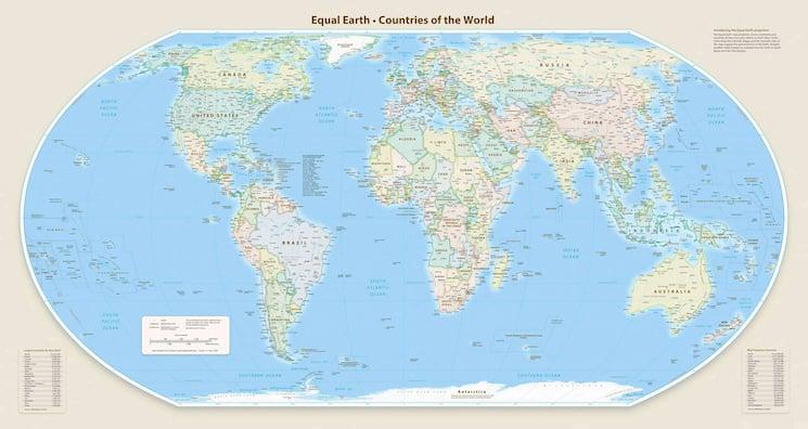
The BBC said the Mercator map has been in common use since the 16th Century and that it shows Africa as similar in size to Greenland even though it is 14 times larger.
In the run-up to the vote, Togolese Foreign Minister Robert Dussey told the Reuters news agency, "A fair world begins with a fair map."
The BBC also quoted Africa No Filter’s Lerato Mogoatlhe saying, "Africa's misrepresentation on world maps is not just a cartographic error - it's a narrative issue."
US objects, others push change
The Guardian reported that at the UN general assembly session in New York, 164 countries voted in favour of the resolution, with only the US voting no and six abstentions, and it said UN resolutions are non-enforceable.
The Guardian quoted the US representative’s objection that the resolution was "superfluous," while it described Togo as spearheading the campaign on behalf of the African Union.

Before the vote, Robert Dussey told the UN that "This discussion is not a political discussion [but] a scientific discussion, because there is scientific proof so we all have to accept the reality."
The BBC framed the Mercator debate around how maps shape perceptions, quoting Kenyan geographer Kioko Muendo saying, "Maps are more than just guides for travellers - they shape how regions are perceived politically and economically," and it tied that to Africa’s resources, population and investment opportunities.
The Emirates 24|7 account said the resolution received the support of 107 countries in a recorded vote on Friday and encouraged the use of the Equal Earth map projection as an option for more accurate representation of continental landmasses.
What happens next for maps
The resolution supports the use of the Equal Earth map projection and encourages member states, international organisations and relevant entities to adopt equal-area projections where accurate representation of continental sizes is important, while also calling on UN agencies including UNESCO and the United Nations Development Programme to cooperate with the African Union and academia.
“The resolution supports the use of the Equal Earth map projection as an option”
The Guardian said the outcome is expected to result in an update of classroom curriculums and everyday technology given the wide usage of the Mercator projection in education, technology and governance.
The text also encourages countries to integrate critical education on cartographic principles into school curricula and raise awareness among educational and scientific institutions and the media about biases resulting from map projections.
The BBC reported that the UN vote is non-binding but will see changes to the maps used by institutions around the world, and it noted that a team of cartographers in 2018 created an equal area map called the Equal Earth projection.
In a separate framing, the Guardian said France would abandon the Mercator projection for its world maps and use the Eckert IV projection, which it described as close to the Equal Earth projection recommended in the resolution.