
Full story
Floods, missing, and science
A flash flood and mudslides struck the Rasuwagadhi region and nearby areas near the Chinese border, with Nepali authorities reporting an increase in the death toll to 469 dead and more than 1,300 people missing.
“registered magnitude 5.2, was actually caused by an ice collapse”
The flooding was tied to a chain of events in which the United States Geological Survey said it had detected an earthquake before the floods, then revised its data to indicate that the seismic event, which registered magnitude 5.2, was actually caused by an ice collapse.
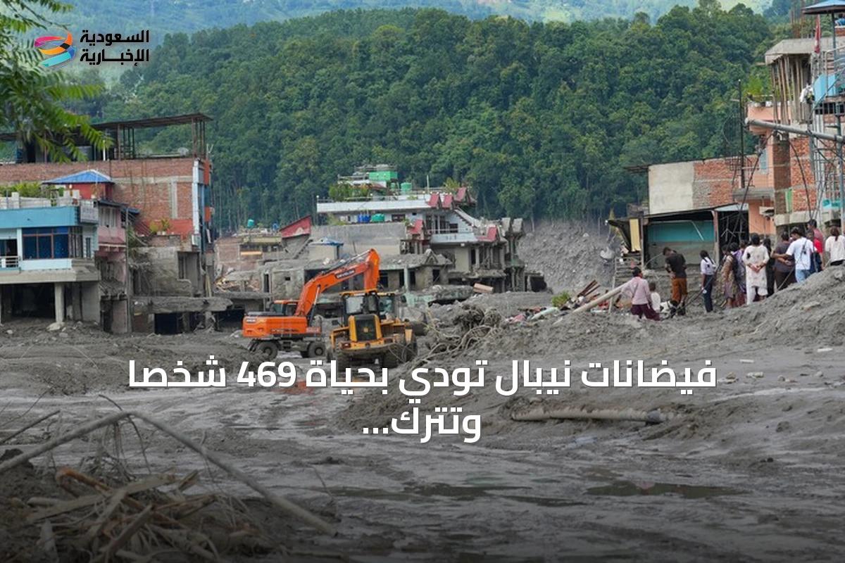
Experts at the Integrated Mountain Development International Centre (ICIMOD), based in Kathmandu, said the collapse of ice in mountainous areas led to a glacial outburst flood that caused the flooding.
In parallel, China’s official television CCTV reported three deaths and 558 people missing on the Tibetan side of the border, while Nepal’s latest official toll indicated 359 killed and 910 others missing.
Search and rescue operations were supported by helicopters after floodwaters destroyed dozens of bridges and caused substantial damage to roads, according to officials cited in the reports.
What triggered the surge
ABC News said the flooding occurred in the northern Rasuwa district along the border with Tibet at around 8:40 a.m. local time on Wednesday, and it reported that the wall of water descended from the mountains caused destruction at least 62 miles downriver.
ABC News also reported that the flood was reportedly triggered by a landslide about 12 miles northeast of the Rasuwagadhi border post along the Nepal-China frontier, and that a 5.2-magnitude landslide was registered in Nepal on Wednesday according to the U.S. Geological Survey.

The same reporting described a seismic sequence in which seismic activity from the landslide was initially erroneously reported as a 4.4-magnitude earthquake, before USGS clarified the signal was generated by the landslide itself.
A geophysicist at Columbia University in New York told ABC News it appeared a landslide in the Himalayas took away a large glacier, or parts of one, in the mountain pass.
The USGS estimated that more than 100 million cubic meters of ice, rock and debris were displaced in the event, according to ABC News.
Barrier lake risk and response
Two days after the glacier collapse, Al Jazeera reported that a newly formed river breach on Friday halted rescue operations at the Nepal-China border after flash floods and mudslides led to 469 confirmed deaths.
“"We can see that the level of water in the river is rising."”
Al Jazeera said officials in Nepal’s Rasuwa district were notified that the barrier lake had begun to overflow, and it quoted Narendra Pariyar saying, "We can see that the level of water in the river is rising."
The report added that Chinese authorities mobilised an engineering team of eight members to carry out aerial surveys and 3D modelling of the barrier lake, and it cited CCTV reporting the effort.
Al Jazeera also quoted Pawan Bhattarai, assistant professor at Tribhuvan University, saying, "The new lake appears to be an avalanche-induced barrier lake."
It further described the risk as not just the lake itself but the possibility of sudden dam failure, warning that even a short-lived breach could generate a fast-moving debris-laden flood with very little warning for downstream communities.