
Technology and Science · 31 July, 2026 · 2 min read
Google Pulls Nano Banana 2 AI Image Feature From Google Earth After Deepfake Concerns
Google Earth briefly enabled Nano Banana 2 to generate AI images on satellite views. The feature was withdrawn within a day due to misinformation and deepfake concerns.
How confident audiences can be in SynthID/watermarks and verification.
7 of 8 outlets skipped it: the tool was only available for desktop use..
21outlets compared
Same story, two versions
tap a side to read it in full
blog.google
“Now Nano Banana 2’s image generation capabilities in Google Earth can show you”Read the original ↗
Martin Cid Magazine
“Coupling a text-to-image generator to that surface is not adding a creative toy”Read the original ↗
Google markets education; outlets stress deepfake risk and evidentiary harm.
Nano Banana in Earth
Google pulled a new AI image-editing feature from Google Earth less than 24 hours after launch, after the company integrated Nano Banana 2 so users could generate images on top of Google Earth satellite, aerial, and 3D imagery using text prompts.
“Google pulled a new AI image-editing feature from Google Earth less than 24 hours after launch”
In the first day of availability, AI researcher Henk van Ess said he created “fake refugee camps along the US-Mexico border and a nuclear plant in Iran,” using the tool before Google reversed course.
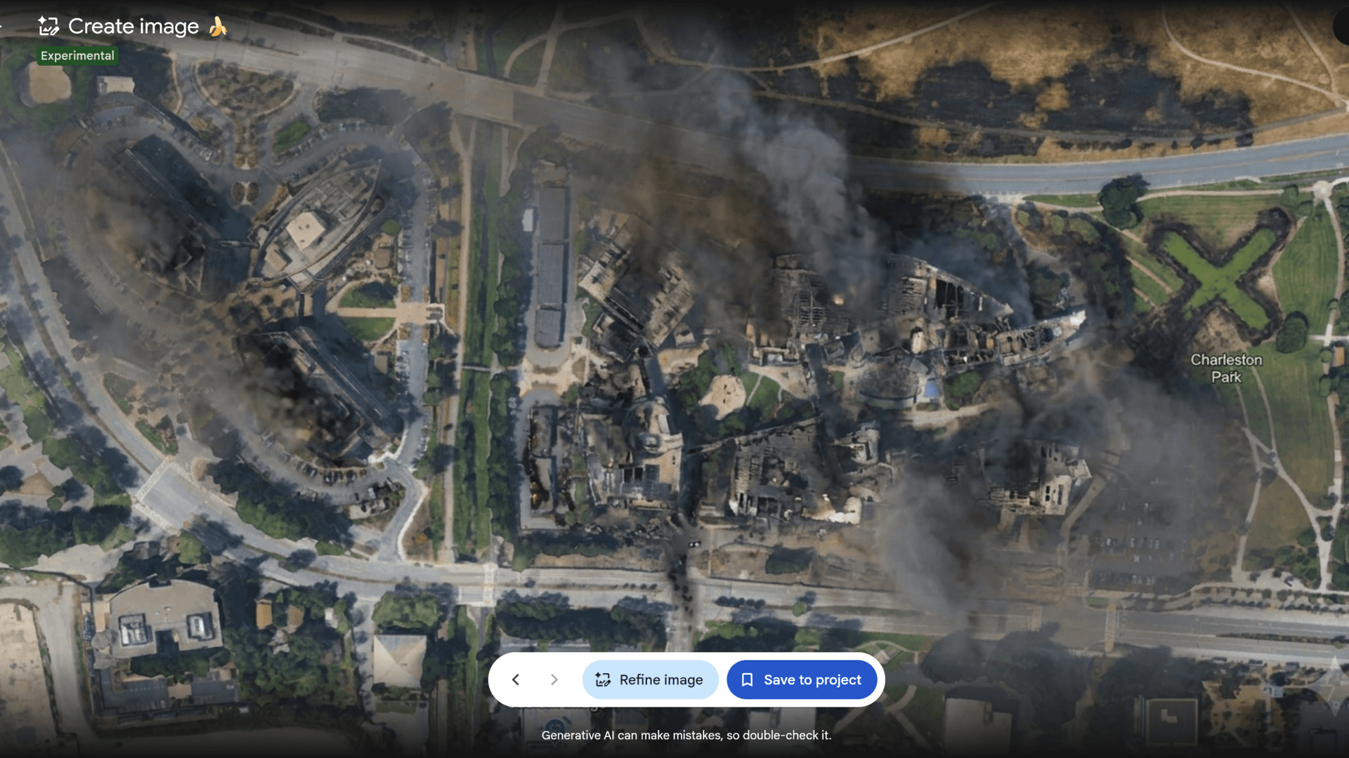
Google’s spokesperson said the company saw “people sharing screenshots of generated imagery that appear to violate our policies,” and it responded by rolling back the feature while it worked on stronger guardrails.
The feature was designed to let users “pick a spot on the map, and start bringing your ideas to life,” but it also enabled users to overlay fabricated scenes onto real-world coordinates.
By Friday, Google said the generated images were watermarked and “never appeared in the public Google Earth experience,” even as screenshots circulated online.
Watermarks and bypasses
BBC Verify reported that Google rolled back the feature after experts raised concerns about misuse and the potential to spread misinformation, noting the tool enabled users to create false scenarios on top of real satellite, aerial, or 3D imagery.
Henk van Ess told NPR via text that “Nothing was refused,” describing tests where he generated images including “refugees at the Mexican border” and “a nuclear plant in Iran.”
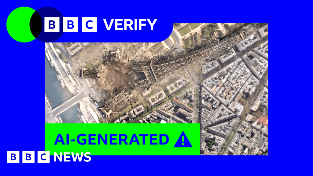
BBC Verify also quoted van Ess saying the forgery “inherits the credibility of the map it was born on,” and it warned that the credibility of Google Earth could be used to make fakes travel further.
The BBC reported that while Google said SynthID watermarks and checks in Gemini or Lens could help, it found “it was possible to circumnavigate these checks and trick Gemini into saying these fake Google Earth images are real.”
Trust, verification, and fallout
The BBC described how Google Earth is used as an entry point to openly accessible satellite imagery, and it quoted Bill Greer of Common Space saying satellite imagery has historically been seen as “an especially trustworthy source of data.”
“an especially trustworthy source of data”
BBC Verify warned that falsified satellite imagery can already be used to spread misinformation, and it quoted Henry Ajder saying fake imagery in conflict zones could be “destabilising” when events are fast-moving and information is scarce.
The Verge’s account said Google’s AI deepfake tool “only lasted one day,” and it cited van Ess pointing to a test where he said “Nothing was refused, nothing was softened, and nothing suggested I try a different prompt.”
In Google’s own update, the company said it was “rolling back this feature in Google Earth while we work on implementing stronger guardrails,” after it saw screenshots that appeared to violate its policies.
The incident left researchers and journalists facing a harder verification environment, with BBC Verify emphasizing that even when checks work, not everyone will verify and the constant doubt can erode trust in trusted sources.