Mexico · updated 1h ago · 2 min read
Hurricane Polo Reaches Category 5 Off Mexico, Threatens Guerrero, Michoacán, Colima, Jalisco With Flooding
Polo reached Category 5 off Mexico with maximum winds around 160 mph. It threatens life-threatening flooding in Guerrero and Michoacán.
Whether US coastal impacts are imminent.
5 of 6 outlets skipped it: mexico’s Navy shut down ports in Guerrero and Michoacán.
17outlets compared
Same story, two versions
tap a side to read it in full
ABC7 Los Angeles
“the storm is expected to bring hazardous rip currents and the potential for high surf”Read the original ↗
CBS News
“For those in the watch area, such conditions could potentially develop by Thursday.”Read the original ↗
ABC7 emphasises Southern California surf and rip-current timing, while CBS keeps the focus on Mexico’s warnings and rainfall impacts.
Category 5 Near Mexico
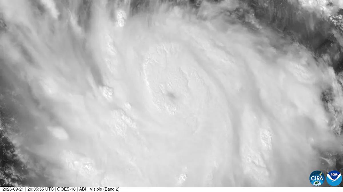
Hurricane Polo intensified into a Category 5 storm off Mexico’s Pacific coast, with the Mexican National Weather Service reporting sustained winds of 265 km/h and gusts up to 322 km/h.
The U.S. National Hurricane Center said Polo had maximum sustained winds of 160 mph and was moving east-southeast at 5 mph, with a forecast to sharply turn northwest and west-northwest.

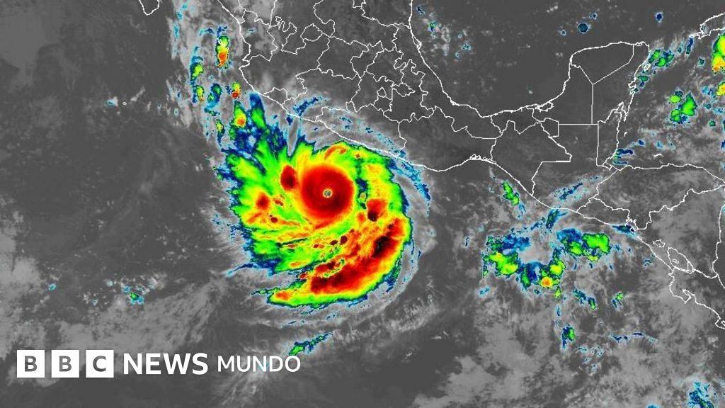
The storm’s center was located 345 km south of the port of Zihuatanejo, Guerrero, moving northwest parallel to the Mexican Pacific coast by midday this Tuesday.
The track would avoid a direct landfall in coastal communities in the coming hours, but it would bring heavy rains and risks of flooding and landslides in Guerrero, Michoacán, Colima, and Jalisco.
The SMN warning said Polo was forecast to generate wave heights of 3.0 to 4.0 meters along the coasts of Michoacán and Guerrero.
Warnings, Rain, and Schools
The National Hurricane Center warned that heavy rainfall may produce life-threatening flooding and mudslides, especially in areas of steep terrain, as Polo moved offshore near the coast.
Educational authorities suspended classes in municipalities along Guerrero and Michoacán’s coasts for this Tuesday and Wednesday.
Claudia Sheinbaum, the president of Mexico, said, "Please, to all Pacific coast residents, stay very alert. So far there are heavy rains... It does not appear that it will make direct landfall," at her morning press conference.
The U.S. National Hurricane Center warned there was still uncertainty about how close the hurricane would come to the coast, and it seemed likely that there would be some wind, rain, and wave impacts as Polo approaches its peak.
The Mexican government issued tropical storm watches and the storm was expected to turn away from the Baja California peninsula, preventing a direct impact on ports like Los Cabos or La Paz in the southern part of that region.
What Comes Next
The National Hurricane Center forecast that Polo would likely continue to strengthen through Wednesday and bring tropical storm conditions to parts of the coastline starting Wednesday morning. Polo’s explosive intensification placed it among the three systems that have strengthened to the maximum category of the Saffir-Simpson scale the fastest, alongside hurricanes Otis (2023) and Patricia (2015). Polo was driven by the El Niño phenomenon and sea surface temperatures in a key region of the central-eastern Pacific on September 19 were 3.05 °C above the average.
Adam Scaife, head of long-range forecasting at the UK Met Office, said, "Scientists are still evaluating whether the impacts will be proportional to its magnitude, but we are already observing the anticipated effects around the world." The El Niño phenomenon can provoke major changes in climate patterns worldwide, including a reduction of hurricane activity in the Atlantic due to changes in wind patterns in the upper atmosphere.