Climateupdated 1h ago3 min read
Hurricane Isaias Strengthens Into Hurricane, Triggers Warnings for Mobile and Baldwin Counties
Isaias strengthened into a hurricane with 80 mph maximum sustained winds. Hurricane warnings issued for Mobile and Baldwin counties, Alabama.
14 outlets told this the same way.
Outlets did split on U.S. Supreme Court Weighs Boulder Climate Lawsuit Against Suncor And ExxonMobil →
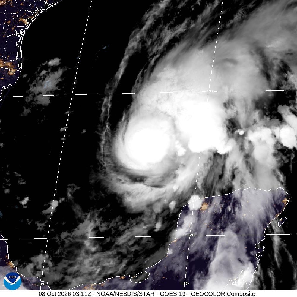
Isaias becomes hurricane
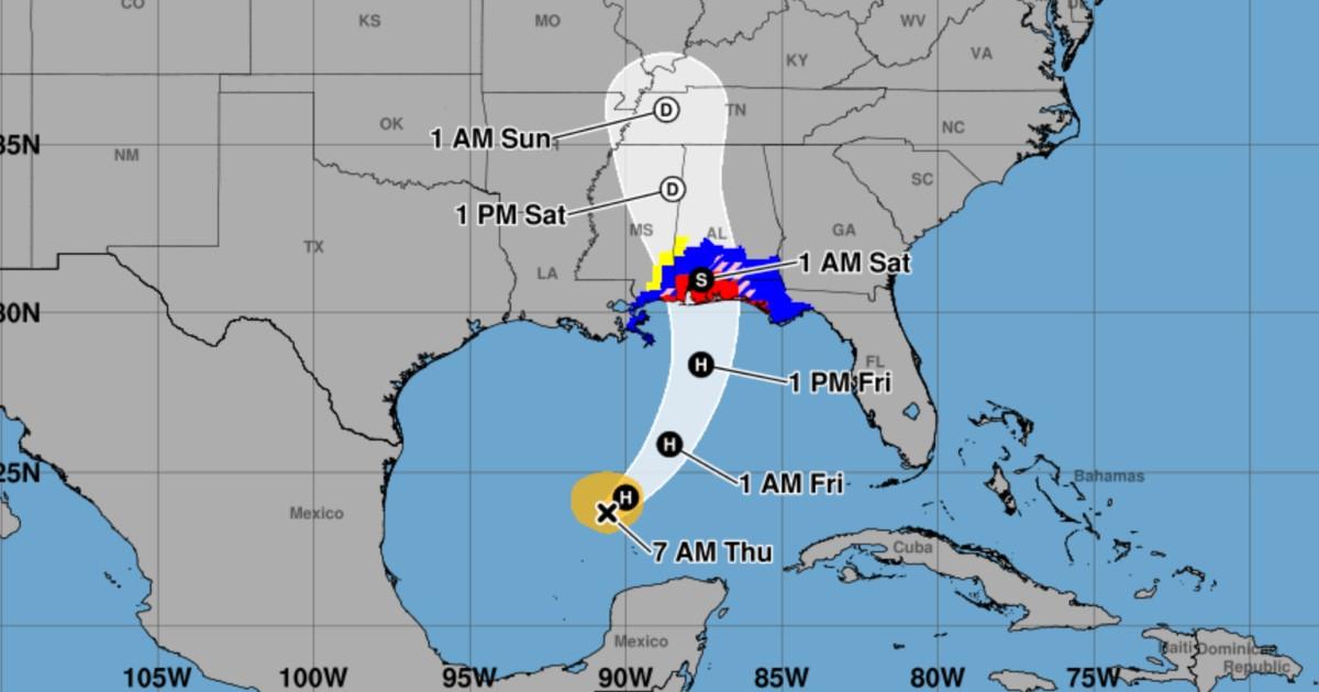
Hurricane Isaias strengthened into a hurricane as a Hurricane Warning took effect for Mobile and Baldwin counties, while a Hurricane Watch and Tropical Storm Watch extended farther inland in Alabama. The National Hurricane Center forecast landfall between Biloxi, MS and Panama City, FL on Friday evening with wind speeds of 95-105 mph, and the Alabama Emergency Management Agency said Isaias would rapidly drop to tropical storm-force winds of 65 mph soon after landfall very early Saturday morning. Hurricane Isaias was found to have maximum sustained winds of 85 mph and was located 380 miles south of the mouth of the Mississippi River in its 10 a.m. report Thursday.
“As of 4 am, Isaias is now a hurricane.”
The National Hurricane Center warned that “additional strengthening is expected through early Friday, and Isaias should remain a strong hurricane as it approaches the northern Gulf Coast on Friday night.” By Sunday evening, the Alabama Emergency Management Agency said there would likely be areas of 2-4 inches total rainfall across much of the state, with 3-6 inches in the far southern sections where the Flood Watch will occur.
Watches, warnings, and surge
The National Hurricane Center issued a Hurricane Warning from Ocean Springs, Mississippi, to the Bay/Gulf County line in Florida, and it also set a Storm Surge Warning from the mouth of the Mississippi River to the Steinhatchee River in Florida. Storm surge warnings were in effect from the mouth of the Mississippi River to Steinhatchee, Florida, and the Guardian quoted the NWS warning of a “life-threatening storm surge”. NBC 15 WPMI said a Storm Surge Warning was in effect along the coastline with “Surge of up to 5-7ft.” possible, and it said a Hurricane Warning covered all of the coastal counties.
Isaias had sustained winds of 85 mph and was centered in the Gulf just under 400 miles south-southwest of New Orleans, moving to the east-northeast at 10 mph. Storm surge could reach five to seven feet in some areas, while rainfall could reach three to seven inches with some spots getting, up to ten inches.
Preparing for inland impacts
The Alabama Emergency Management Agency warned that gusts of 25-35 mph would occur during the day Friday south of Livingston – Montgomery – Eufaula line, and it said from Friday night into early Saturday there could be gusts over 80 mph in the far southern sections. The National Weather Service told communities from Ocean Springs, Mississippi, to Gulf County, Florida, to prepare for the possibility of “long-duration power outages,” and NBC 6 South Florida reported that governors in Florida and Alabama declared a state of emergency for dozens of counties. Damaging hurricane force-winds are expected over portions of the Florida Panhandle, southern Alabama, and southern Mississippi, and the Guardian urged residents to prepare for “long-duration power outages.”
Heavy rain from Isaias would arrive along the Gulf Coast Friday and push far inland through the rest of the weekend, with most other areas near the Gulf Coast forecast to pick up between 3 and 7 inches. Strong winds could pick up as soon as Friday and continue at least through Saturday morning, with downed trees, power lines and power outages that could last for hours or multiple days possible in areas covered by hurricane and tropical storm alerts.