Climateupdated 1h ago2 min read
Hurricane Isaias Strengthens Into Category 1, Shifts Toward Pensacola Late Friday Night
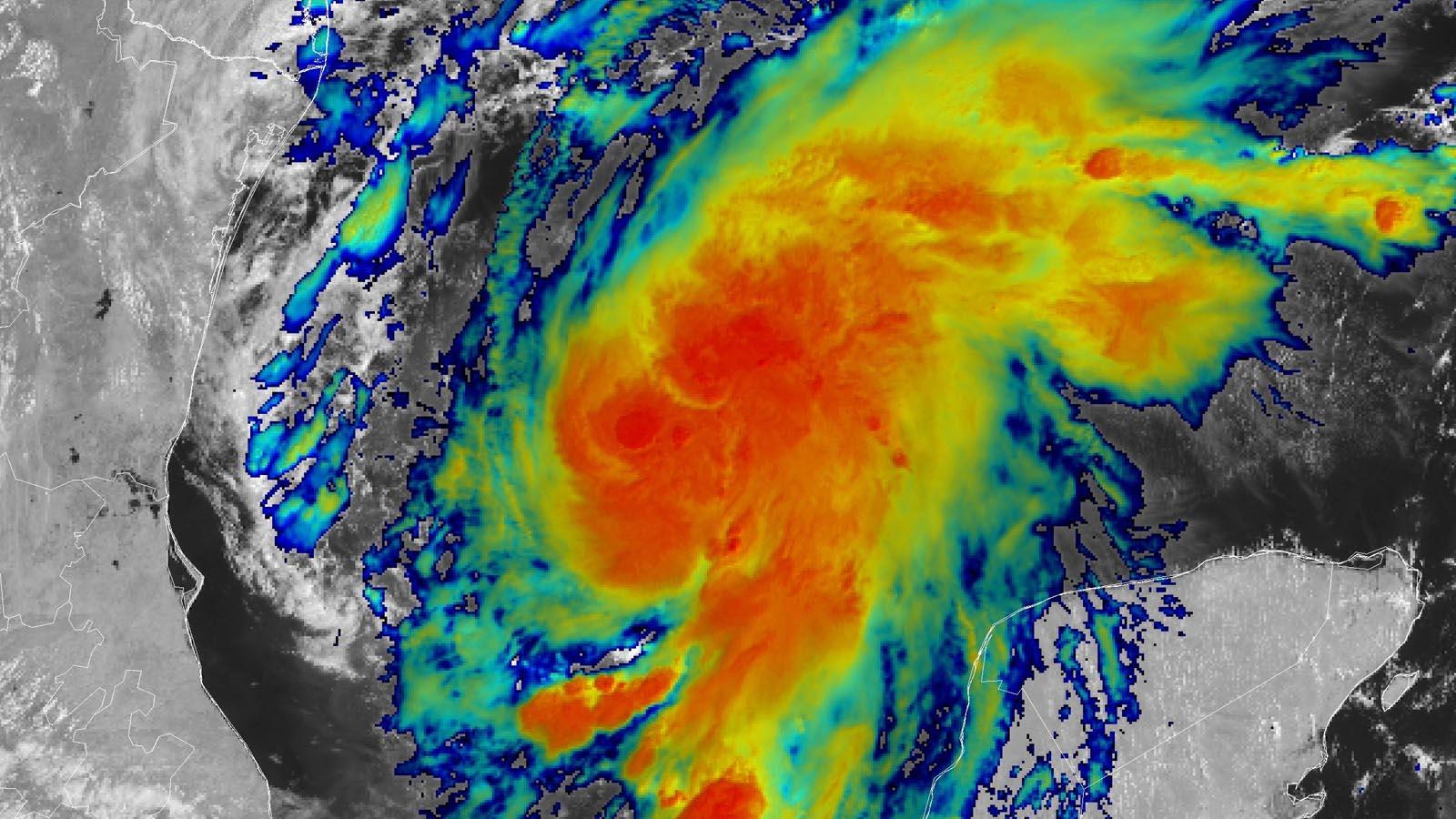
Isaias strengthened into the Atlantic season's first hurricane with sustained winds around 75-80 mph. Forecast landfall along the northern Gulf Coast late Friday or early Saturday.
34 outlets told this the same way.
Outlets did split on U.S. Supreme Court Weighs Boulder Climate Lawsuit Against Suncor And ExxonMobil →
NBC News was read line by line by the Watchdog: 5.0. See the score →
Isaias Becomes Category 1
Hurricane Isaias strengthened into a Category 1 storm with maximum sustained winds of 75 mph as it continued moving north toward the Gulf Coast, making it the first Atlantic hurricane of the season.
The National Hurricane Center confirmed late Wednesday night that Isaias had strengthened into a Category 1 storm, and the latest forecast showed the storm shifting more east with landfall closer to Pensacola late Friday night.

Florida issued a state of emergency order Tuesday evening for 25 counties, and Alabama issued one for 40 counties as Isaias approached.
Wind gusts reached 85 miles per hour as of Thursday morning, and hurricane and storm surge warnings were in effect for parts of the northern Gulf Coast.
The storm was expected to produce 3 to 7 inches of rain across the central U.S. Gulf Coast from Friday through the weekend, with localized totals of up to 15 inches.
Warnings, Evacuations, and Surge
The hurricane warning spanned from Ocean Springs, Mississippi, to the Bay/Gulf County Line in Florida, and storm surge warnings covered the mouth of the Mississippi River to the Steinhatchee River in Florida.
CBS News said hurricane-force winds extended outward up to 15 miles from the storm's center, while tropical-storm-force winds extended outward up to 90 miles.
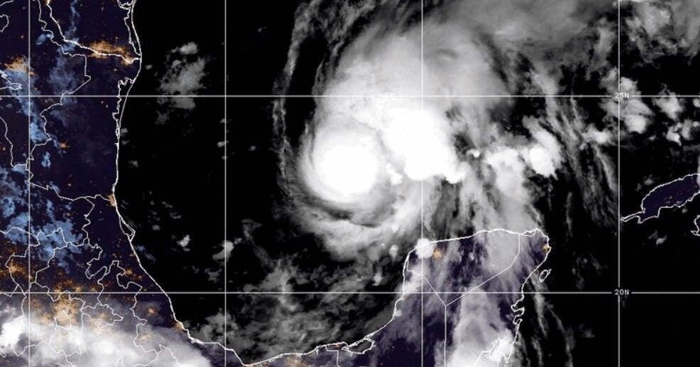
Florida Gov. Ron DeSantis declared a state of emergency for more than two dozen counties, and Alabama Gov. Kay Ivey issued a state of emergency for 40 counties as preparations intensified.
Mandatory evacuations were ordered in parts of Florida's Okaloosa County, with the orders set to take effect Thursday at 12 p.m. ET, while officials in the city of Gulf Shores urged non-residents to leave to reduce congestion.
The National Hurricane Center forecast 3 to 7 inches of rain and as much as 10 inches in some places along the coast from southeastern Louisiana to the Florida Panhandle, and storm surge warnings covered a wide stretch of the Gulf Coast.
Energy Shutdowns and Climate Stakes
Energy companies paused offshore operations in the Gulf of Mexico due to Hurricane Isaias, and Daily Beirut estimated a possible loss of about 11.2 million barrels of crude oil production during the storm period. Daily Beirut said official data showed a temporary cessation of about 25.08% of total offshore oil production in the region, equal to 511.619 thousand barrels per day, and it said 16.37% of natural gas production was halted at 350.25 million cubic feet per day. Royal Dutch Shell stopped production entirely and evacuated non-essential staff from the Mars, Olympus, Ursa, Vito, and Appomattox facilities, while Chevron began shutting down production at four facilities and maintained operations at five other facilities.
NPR linked the storm's potential intensity to warm Gulf conditions, saying sea surface temperatures were around 87 degrees, and it also tied warmer sea surface temperatures to human-caused climate change. NPR said Isaias could bring up to 10 inches of rain to some areas, with 3 to 7 inches possible from southeastern Louisiana to the Florida Panhandle over the weekend, as the storm approached the southeastern U.S.