Technology and Scienceupdated 2h ago2 min read
National Hurricane Center Raises 92L Tropical Depression Probability To 90% In Southwestern Gulf
NHC raised 92L formation probability to 90% for tropical depression in southwestern Gulf. System could become Isaías, with potential impacts on Gulf Coast and Yucatán.

NHC raises 92L odds
The United States National Hurricane Center raised the probability that a tropical depression will form in the southwestern Gulf of Mexico to 90% in its official 8:00 a.m. EDT bulletin.
The NHC said the system, designated as 92L, progressed from a 10% chance of formation within 48 hours to a 90% chance of development in less than 24 hours.
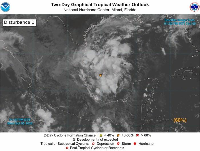
The NHC described the disturbance as "showers and thunderstorms with signs of organization" tied to a broad area of low pressure over the southwestern Gulf of Mexico.
The NHC warned that "It is still too early to determine specific impacts on the northern Gulf coast" while it expected the low-pressure area to trigger strong winds and heavy rains in western areas of the Yucatán Peninsula, Mexico.
The NHC said NOAA’s Gulfstream aircraft is scheduled to sample the environment over the Gulf later today, and an Air Force reconnaissance aircraft is scheduled to investigate the system tomorrow.
Mexico and U.S. watch
Tropical disturbance 92L, also labeled Invest AL92, increased its probability of cyclone development to 90% as it showed rapid organization over the southwestern part of the basin. The threat of torrential rains kept Tamaulipas and San Luis Potosí under maximum vigilance, directly impacting the eastern part of the Huasteca Potosina. The National Weather Service (SMN) warned that the interaction of the system with low pressures would favor a period of heavy rain to torrential downpours on Tuesday and the coming days, mainly along the Tamaulipas coasts and the eastern portion of the Huasteca Potosina.
Nola.com said forecasters with the National Hurricane Center expected the disturbance to become a tropical depression in the next day or so, and it said Louisiana, Mississippi, Alabama and Florida should monitor the progression of the invest. John Cangialosi told Nola.com that the system could bring gusty winds and heavy rain to the western portion of the Yucatan Peninsula of Mexico in a couple of days.
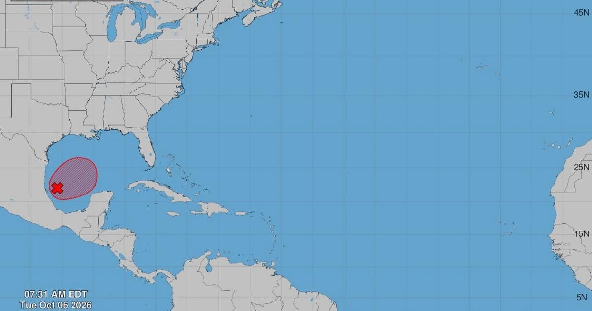
Rain, flood risk, and naming
FOX Weather said the NHC designated the brewing tropical disturbance as Invest 92L and gave the system high odds of becoming at least a tropical depression over the next two days. The FOX Forecast Center said, "A more defined system in the southern Gulf will be able to defend itself from the hostile conditions," while it also said uncertainty about track and intensity remained high. The next name on the list is Isaias and the system could become a tropical storm or hurricane before reaching the north of the Gulf by the weekend.
The WPC of the National Weather Service forecast a Level 2 out of 4 flash flood risk for this weekend, covering much of the Southeast from the north of Florida to Louisiana. A buoy about 125 miles east of the estimated center of 92L recorded a pressure of about 1008 milibares as the disturbance organized over the southwestern Gulf.