Technology and Science27 September, 20262 min read
El Niño Fuels Hurricane Polo, Nolo, Odalys in Pacific as Atlantic Stays Quiet With Fay
This article is an automated aggregation of coverage from news outlets. Our editorials offer in-depth analysis curated by the NewsCord team.
Pacific remains highly active with Polo and Nolo, while Odalys is monitored. Atlantic activity is subdued due to El Niño effects suppressing storms.
Two basins, one El Niño
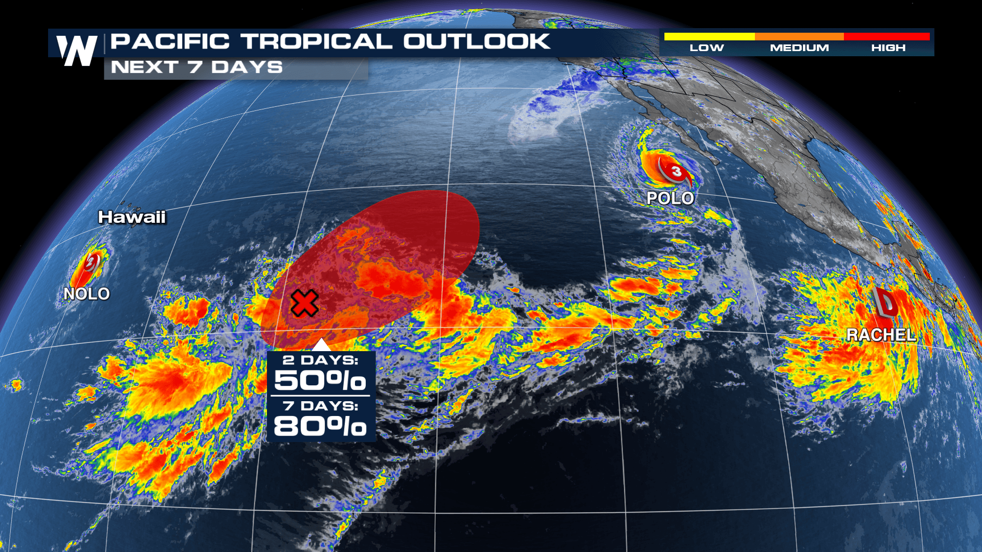
El Niño has left the Pacific “booming with storm activity” while the Atlantic stays “relatively quiet,” and the contrast is shaping the 2026 hurricane season across two ocean basins. The National Hurricane Center is tracking three active systems in the Pacific, including Hurricane Polo (Category 3) with “120 mph sustained winds,” Hurricane Odalys (Category 1) with “75 mph winds,” and Hurricane Nolo (Category 2) south of the Big Island of Hawaii. Hurricane season remains very active in the Pacific, listing Polo and Nolo plus tropical storms Odalys and Rachel, while the Atlantic is much lower in activity with Fay “hanging on” as it fights hostile conditions.
“The Pacific is booming with storm activity, while the Atlantic is relatively quiet.”
Only seven tropical storms have formed in the Atlantic while 18 tropical storms and hurricanes have formed in the Pacific, and the imbalance is tied to El Niño and to conditions that disrupt tropical waves. USA TODAY said only seven tropical storms have formed in the Atlantic while 18 tropical storms and hurricanes have formed in the Pacific, and it tied the imbalance to El Niño and to conditions that disrupt tropical waves.

Forecasts and named storms
Moisture from both Odalys and Polo is expected to be drawn into the Southwest U.S., fueling thunderstorms with flooding rain from Monday into mid-week. Polo is expected to curl to the northeast and “slam into Mexico's Baja California as a hurricane on Monday,” with “damaging winds, flooding rainfall and storm surge.” Hurricane alerts are in effect for parts of the Pacific coast of the Baja Peninsula north of Los Cabos, and Nolo is passing south of Hawaii while continuing to bring gusty winds to parts of the island chain.
WeatherNation described Polo as a Category 5 hurricane after “undergoing extremely rapid intensification,” and it said Polo once had a central pressure of “892 mb.” Nolo is “just south of the Big Island of Hawaii,” and the Atlantic is quiet as “record wind shear continues to tear apart tropical waves moving off Africa.”

What scientists are watching
Meteorologists and climate scientists have watched tropical waves and storms from their origins using a fleet of satellites operated by the National Oceanic and Atmospheric Administration, and more than 60 years after satellites began helping observe hurricanes, scientists are still learning how waves begin and develop. Conditions in both basins are at least partially linked to the “super El Niño,” and El Niño is not the only factor keeping hurricane activity tamped down. A drought in Ethiopia has contributed to the quiet Atlantic season, and waves that originate over the Ethiopian Highlands are more likely to become hurricanes because the Ethiopian mountains help form big storm clusters.
“For the first time in over 100 years, no full-blown hurricanes have formed in the Atlantic as of September 25.”
For the first time in over 100 years, no full-blown hurricanes have formed in the Atlantic as of September 25, and Gabriel Vecchi said, “The Pacific: incredibly active. We are headed toward what will almost certainly be the strongest El Niño on record,” and El Niño increases wind shear in the North Atlantic and fuels storms in the Pacific.